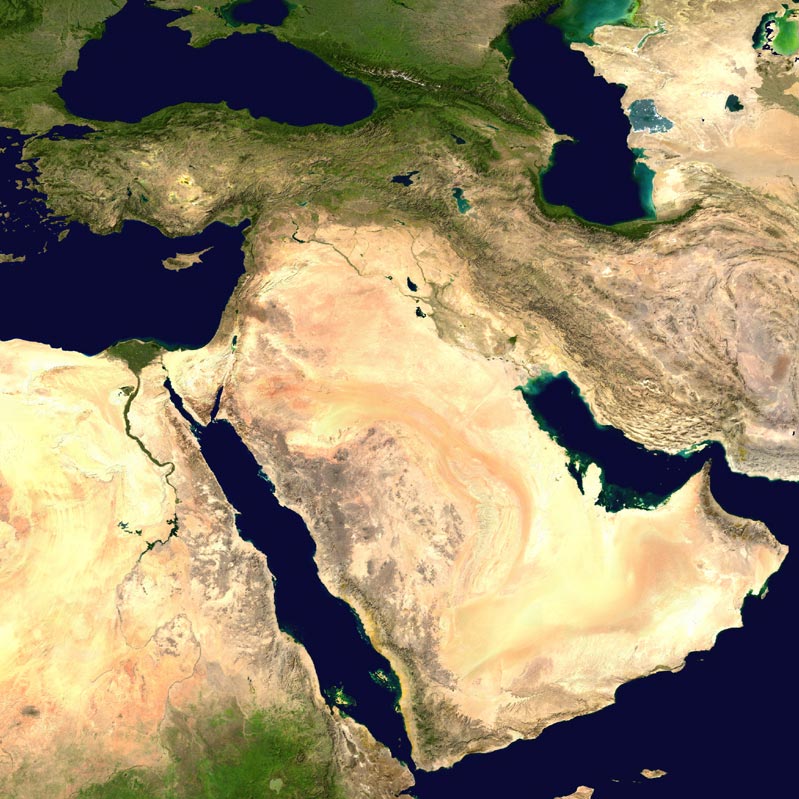
North Africa and the Near East

Field Projects
Nubian Expedition
Ancient Nubia, particularly the culture known as Kush, was one of Africa's earliest centers of political authority, wealth, and military power. Distinctively different from the urban bureaucracy of ancient Egypt—its neighbor enemy to the north—Kush derived its power in part from its control over rich sources of gold and from its role in transporting goods between sub-Saharan Africa and the Mediterranean.
Kush was conquered by the Egyptian empire of the New Kingdom beginning in about 1550 BC. With the collapse of Egyptian control in the years after 1100 BC, little is known about Kush, although new excavations are beginning to shed light on this dark age. However, we do know that beginning after 900 BC, a new political center had emerged at El Kurru, where a series of burials beginning with Nubian-style tumuli and developing into Egyptian-style royal pyramids marks the rise of the Napatan dynasty. The kings buried here would conquer Egypt and rule as its 25th Dynasty, and are sometimes known as the "Black Pharaohs." They would also fight against the invading Assyrian empire in battles described in the Hebrew Bible.
The rise of the Napatan dynasty remains poorly understood, and as the earliest of its political centers, El Kurru is critical to understanding these developments. The royal burials at Kurru were excavated by George Reisner in 1918-19. In his notebooks, he referred to a royal city that was adjacent to the cemetery, with features including a 200-meter-long stretch of city wall, a city gate, temples, and a large rock-cut well that he interpreted as belonging to a royal palace. He did not investigate these remains in any detail, and in fact they are not visible on the site today, most likely due to high Nile floods that occurred several times during the 20th century.
The University of Michigan's Nubian Expedition, directed by Geoff Emberling began a new field project at El Kurru in January of 2013 that aims to relocate this ancient royal capital. We hope it will help us understand the rise of the Napatan dynasty as well as provide insight into society in Kush during this time. See the show Rise of the Black Pharaohs
Vani Regional Survey
An archaeological survey of the region around Vani in western Georgia, directed by Christopher Ratté , was begun with sponsorship of the University of Michigan and the Institute for the Study of the Ancient World at New York University in 2009.
Vani is one of the most intensively studied archaeological sites in the western Georgian region of Colchis, famously the farthest shore in Greek mythology, the land of the golden fleece and home of Medea. Excavations have revealed a continuous occupation sequence extending from the 8th to the 1st centuries BC. Especially notable are the rich and unusual graves of the Classical period (6th-4th centuries), the monumental stone architecture of the Hellenistic period (3rd to 1st centuries), and the extensive evidence for interaction with the Mediterranean and Near Eastern worlds, including not only commercial and luxury imports (Greek transport amphorae, fine bronze and silver utensils from both the Greek world and Persia) but also local production of bronze sculpture and one long Greek bronze inscription.
Half a century of scientific excavation has produced a detailed model of the history of the site and generated a rich series of hypotheses about its purpose and function in different periods. One of the more enigmatic features of Vani as currently understood is the very limited evidence for residential occupation at any time. Together with its other unusual features, this raises fundamental questions about the evolving character of both the site and the society it represents. What is the relationship between Vani and other sites in Colchis in various periods? What other sites are similar in terms of topographical situation, size, architecture, tombs, and other aspects of material culture? More locally, how extensive was the ancient settlement? Was Vani a regional population center, a sanctuary, or both? What were its regional economic and political functions?
In addition to ongoing research at Vani itself, regional survey provides one obvious approach to some of these questions, and here too there is a rich tradition of earlier research to build upon. Survey and excavation at a number of sites have yielded remains extending in date from the Early Bronze Age to the medieval period. Of special interest are a number of settlements and rich graves coincident with the main occupation periods at Vani.
The purpose of the Vani Regional Survey project begun in 2009 is to integrate existing knowledge about Vani and environs into the kind of technological and conceptual framework characteristic of contemporary American survey archaeology. Of particular importance is the use of GIS as an organizational and analytical tool and geophysical prospection both in the immediate environs of Vani and at regional sites. The combination of Georgian archaeological expertise and American technological, intellectual, and other resources will shed new light on the regional significance of Vani throughout antiquity.
Abydos Middle Cemetery Project
The large and multicomponent site of Abydos lies about 400 kilometers south of Cairo in upper Egypt, on the west bank of the Nile River. Located at the margin of desert and floodplain, Abydos was never a capital or seat of central government during the Dynastic era (3100-332 BC) but was always an important ceremonial site for both royal and private individuals. The site was ultimately identified as the burial place of the god Osiris, king of the underworld, and the primary entrance to that next world. As such, it was maintained as a coherent conceptual landscape for more than 3,000 years.
The primary burial ground for nonroyal individuals in the Old Kingdom was a part of the site called the "Middle Cemetery" by modern excavators. Previously investigated in the 1860s by the flamboyant first director of the Egyptian Antiquities Organization, Auguste Mariette, the Middle Cemetery was known to have yielded inscriptions from the graves of important Sixth Dynasty officials (2407-2260 BC). Among these inscriptions discovered in the early years of Egyptian archaeology was the long and colorful autobiography of Weni the Elder. This life story, a well-known piece of ancient Egyptian literature, was most likely excavated from the monumental surface chapel of a tomb, called a mastaba (Arabic for "bench," describing the shape of these structures). A later series of British missions in the late 19th and early 20th centuries provided evidence that a substantial lower-order cemetery of far simpler graves bracketed the area from which these inscriptions came; however, because of the haphazard nature of Mariette's work, the development and significance of the elite component of the provincial cemetery, which he described as located on a "high hill," had never been well understood. No subsequent excavators worked in Mariette's portion of the Middle Cemetery until the Kelsey Museum applied for permission to resume excavations there in 1995.
The University of Michigan received permission from the Supreme Council of Antiquities (Ministry of Culture, Egypt) to investigate the entire Middle Cemetery at Abydos and began to work in this cemetery in cooperation with the Pennsylvania-Yale-Institute of Fine Arts/New York University Expedition, which was then excavating the ancient town in which Mariette's officials would have lived. Two initial seasons of topographic mapping and surface survey of ceramic, architectural, and artifactual remains resulted in the creation of a detailed contour map of the entire Middle Cemetery and confirmation that late Old Kingdom ceramic material and mudbrick construction did indeed dominate this area. Two full-scale seasons of excavation (1999 and 2001) and two further seasons of magnetic survey (2002 and 2004) later, the spatial organization of the cemetery began to emerge, along with new facts regarding the late Old Kingdom individual Weni the Elder, and the political agenda underlying the development of the Old Kingdom mortuary landscape at Abydos.
The University of Michigan work, directed by Janet Richards has demonstrated that use of the Middle Cemetery at Abydos had a definite starting point in the later Old Kingdom, most likely motivated by a political desire to promote the central government in the provinces. For several hundred years after the founding of the Early Dynastic royal cemetery near the cliffs, in about 3100 BC, no private burial was allowed anywhere else on the low desert plateau in North Abydos. The Michigan excavations have documented that this taboo was kept in place until sometime in the Fifth Dynasty, about 700 years later, when at least four monumental elite tombs for late Old Kingdom officials were built on the highest prominence of the plateau, flanked by an extensive pattern of tidy rows of subsidiary mastaba graves. Reflecting an idealized view of social relations, the graves of lower-order individuals were placed on an isolated ridge to the northeast, separated by space and topography from the occupants of the elite graves.
In 1999 the Michigan team excavated a broad expanse in the central part of the Middle Cemetery, exposing two large Old Kingdom elite tomb complexes, two subsidiary mastabas and their associated shafts, and a level of votive activity focused on these Old Kingdom structures but dating to the Middle Kingdom 500 years later. One of these tombs proved to be that of Weni the Elder, the governor of Upper Egypt. The tomb's superstructure consisted of a massive square structure nearly 30 meters long on each side and more than 15 meters tall. The team rediscovered the chapel from which Weni's famous biography originally came, as well as new inscriptions and statuary relating to his career; team members also excavated a series of graves situated around his monument, including both burials contemporary with his own and a small Saïte Period cemetery (ca. 685-525 BC) located around the top of his burial shaft.
In 2001 work focused on excavating the burial shafts and chambers for Weni's tomb and that of an overseer of priests, Nekhty, as well as expanding the horizontal exposure of the cemetery surface. The excavation of the chambers yielded unforeseen evidence about the fate of these tombs during the political disturbances of the First Intermediate Period: Weni's chamber was thoroughly burned, perhaps as a deliberate strike against the province by the central government; and it emerged that Nekhty's burial chamber had been usurped from an Old Kingdom official named Idi, possibly as part of the same upheaval.
Elsewhere excavations in 2001 revealed a continuation of the pattern of rows of subsidiary mastabas radiating from these two elite monuments; and results from the two seasons of magnetic survey documented an extraordinarily vast landscape of numerous rows of such graves, as well as the existence of at least two further elite complexes. One of these is most likely that of Weni's father, the Vizier Iuu, documented by Lepsius in the 19th century but subsequently "lost."
The Kelsey Museum plans to continue the long-term investigation of the archaeological remains and their relation to ancient Egyptian society and history in the Middle Cemetery at Abydos in the future. Goals for the Abydos Middle Cemetery Project include a close examination not only of the monumental inscribed tombs of the elite but also of the non-elite graves sharing one of the largest provincial cemetery landscapes of the later third millennium BC.
Tel Kedesh
Tel Kedesh is a large tel site in Upper Galilee, occupying an area of ca. 20-25 acres. It is located on the land of Kibbutz Malkia, some 450 meters above sea level and about 10 kilometers northwest of Hazor. Situated in one of the richest agricultural zones of modern Israel, the area of Kedesh and the Upper Galilee has been home since antiquity to a tapestry of cultural and ethnic groups, from the Israelite tribe of Naphtali to Phoenicians from the nearby city of Tyre.
The University of Michigan/University of Minnesota Excavations at Tel Kedesh, co-directed by Sharon Herbert, began in 1997 to investigate material evidence for Phoenician presence in the Hellenistic and Roman periods. After two exploratory and survey seasons and seven excavation seasons, the team has uncovered evidence of a monumental administrative building dating to the Persian (6th-4th centuries BCE) and Hellenistic (3rd-first half 2nd) periods. The discovery of over 2000 clay seal impressions, or bullae, in 1999 and a Ptolemaic gold coin minted in Cyprus in 2010 attest to the prominence and wealth of Kedesh in the regional landscape.
Tel Brak
From a cultural point of view, Mesopotamia includes not only the land between the Tigris and the Euphrates but the surrounding deserts, foothills and mountains, including parts of the modern countries of Iraq, Iran, Syria, and Turkey. It is the homeland of the world's oldest experiments in statecraft, which occurred during the Early Uruk Period, about 4000 BC. Henry Wright first began working in the region in 1965, and has since worked on excavations and surveys with many colleagues to develop regional data bases on changing environments, populations, settlements, social groups, foodways, crafts, trade, conflicts, and symbolic life between 4500 and 2500 BC.
Wright's recent work has been with the British project at Tell Brak in the dry-farmed wheat belt of Eastern Syria. This long-term work has been directed by David and Joan Oates under the aegis of the McDonald Institute of Cambridge University. From 1998 until 2002, excavations at Tell Brak took place under the field direction of Geoff Emberling and Helen McDonald. From the autumn of 2002 until 2005, as part of the Brak project and with the cooperation of Syria's excellent Department of Antiquities, Wright directed an archaeological survey of the sustaining area around Tell Brak. Analysis of the ceramics from the survey is ongoing as possible.
With intensive surface examination assisted by satellite imagery, survey teams have to date covered all the land within 15 km of Brak, and recorded more than 400 archaeological sites, ranging in age from Paleolithic to early modern times. The most striking result so far is the explosive growth of settlement about 4000 BCE, just as the excavations at Brak indicate that the center was becoming a differentiated urban center with evidence of both economic and political specialization.
Aphrodisias Regional Survey
Aphrodisias is one of the most important archaeological sites of the Greek and Roman periods in Turkey, famous in antiquity for its sanctuary of Aphrodite and its virtuoso sculptors. Excavations at Aphrodisias have been carried out by New York University since 1961 and have revealed an unusually well-preserved and picturesque ancient town, which makes an indelible impression on visitors and brings the civic culture of the Graeco-Roman world vividly to life.
Until recently, however, modern knowledge of ancient Aphrodisias extended only as far as the city's fortification walls. Very little attention had been paid to the monuments outside the gates—beginning with the suburban roads and cemeteries—or to the study of the relationship between the urban settlement and its rural environs. Although the excavations had revealed one of the world's best-preserved ancient cities, important questions about the history of the city had remained unanswered.
The Aphrodisias Regional Survey , directed by Christopher Ratté , was begun in 2005 in order to investigate the interaction between human habitation and the natural environment in a 600-square-kilometer area around Aphrodisias from prehistory to the present day, especially in the Hellenistic and Roman periods. Major fieldwork combining intensive and non-intensive archaeological survey and geological and geographical investigation was completed in 2009. Approximately 670 archaeological points of interest have been recorded and entered into a Geographical Information System (GIS), including tombs, farmsteads and settlements, caves, wine and olive oil presses, quarries, aqueducts and cisterns, rural sanctuaries and churches, and a network of fortified citadels and hilltop watchtowers. The work has been sponsored by New York University and the University of Michigan, with major financial support from the Leon Levy Foundation.
The excavations at Aphrodisias have made significant contributions to the history of the ancient Mediterranean city. Regional survey has extended our knowledge of the site in both time and space--providing new information about Aphrodisias and environs before and after the heyday of the city and illuminating the interaction between town and countryside in numerous ways.
Notion
Notion is a well preserved and almost completely unexcavated Greek city on the western coast in Turkey. The name, Notion, "The place to the south," refers to its relationship with ancient Kolophon, only 15 km inland. Notion is also close to Claros, Ephesos, and Teos. The site was occupied from the early first millennium B.C. until the Middle Ages, and it played an important role in the history of the surrounding region in all periods, from the Ionian migration to the fall of the Roman Empire.
Notion covers an area of approximately 35 ha, enclosed by 3 km long fortifications. The major monuments of the Classical city, such as the theater and the street-grid, are clearly visible in satellite imagery. The first goals of a new program of archaeological research at Notion, directed by Christopher Ratté , begun in 2014 with the sponsorship of the University of Michigan and Brown University, are to make a new map of the site and to begin to develop a long-term conservation plan. The mapping of the site will use a battery of different techniques, including low-altitude photogrammetric survey, geophysical prospection, and documentation of standing architectural remains. The goals of the site management plan are to secure the preservation of the site, and to pave the way for responsible development of its touristic potential, in connection both with neighboring archaeological resources and with attractive harbors on both sides of the ancient city.
Notion is an ideal laboratory for the study of the long-term history of Graeco-Roman city in Anatolia, from the late Bronze Age through the medieval era. Archaeological research at the site will contribute valuable new information on major issues of contemporary west Anatolian archaeology, and secure the future of this invaluable cultural resource.